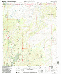
1999 Map of Mule Creek
USGS Topo · Published 2002About this map
Mule Creek serves as a remote hub in the high desert of Grant County, where the settlement is surrounded by a sprawling network of family holdings and cattle operations. The landscape is defined by the Mule Mountains and the northern reaches of the Gila National Forest, a terrain cut by deep drainages like Boiling Canyon and Sawmill Canyon. Water is the critical currency here, evidenced by the high density of livestock tanks including Roadside Tank, Hardluck Tank, and Ball Park Tank. The mapping of established sites like the Larremore Ranch, Harkey Ranch, and Wilkinson Ranch illustrates the long-standing ranching legacy of the region. A solitary Cem near the forest boundary provides a point of interest for genealogists tracing early families in this corner of the New Mexico borderlands.
Find a feature on this map
49 named features on this map. Tap any name to fly to it.
Don’t see what you’re looking for? This feature index may not catch every label — zoom into the map to look around manually.
Map Details
Editions of this 1999 Mule Creek Map
This is the sole edition of this map. No revisions or reprints were ever made.
Other maps of this area

1910 · Mogollon
USGS Topo · 1:125,000

1912 · Mogollon
USGS Topo · 1:125,000

1913 · Morenci
USGS Topo · 1:125,000

1915 · Morenci
USGS Topo · 1:125,000

1954 · Silver City
USGS Topo · 1:250,000

1954 · Clifton
USGS Topo · 1:250,000

1957 · Clifton
USGS Topo · 1:250,000

1958 · Silver City
USGS Topo · 1:250,000

1958 · Clifton
USGS Topo · 1:250,000

1959 · Steeple Rock
USGS Topo · 1:62,500