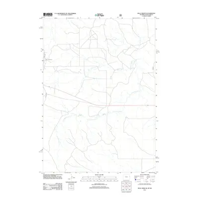
2012 Map of Mule Creek SE
USGS Topo · Published 2012About this map
Mule Creek Oil Field anchors the western edge of this Niobrara County landscape, marking the intersection of resource extraction and the high plains of Wyoming. The terrain is defined by the dendritic drainage patterns of the Moss Agate Cr system, including its north and south forks which wind across the quadrangle toward the South Dakota border. This 2012 survey illustrates the modern transportation corridor where Old US Hwy 85 cuts through the region. The map provides a precise look at the sparse industrial and rural road network that supports the oil industry in this portion of the Powder River Basin, showing how local infrastructure follows the natural contours of the various creek branches.
Find a feature on this map
5 named features on this map. Tap any name to fly to it.
Don’t see what you’re looking for? This feature index may not catch every label — zoom into the map to look around manually.
Map Details
Editions of this 2012 Mule Creek SE Map
This is the sole edition of this map. No revisions or reprints were ever made.
Other maps of this area

1902 · Edgemont
USGS Topo · 1:125,000

1950 · Edgemont SW
USGS Topo · 1:24,000

1950 · Burdock
USGS Topo · 1:24,000

1951 · Twentyone Divide
USGS Topo · 1:24,000

1955 · Hot Springs
USGS Topo · 1:250,000

1955 · Newcastle
USGS Topo · 1:250,000

1958 · Newcastle
USGS Topo · 1:250,000

1978 · Riverview
USGS Topo · 1:24,000

1978 · Mule Creek
USGS Topo · 1:24,000

1978 · Coffee Flats
USGS Topo · 1:24,000