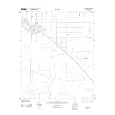
2012 Map of Muleshoe
USGS Topo · Published 2012About this map
Muleshoe serves as the primary hub of this High Plains landscape, organized by a rigid grid of residential streets and agricultural corridors. The town's layout is defined by thoroughfares like W Dallas St, E Birch Ave, and Railroad Ave, reflecting its historic ties to the regional rail network and cattle industry. Beyond the town center, the terrain is characterized by the expansive open spaces typical of Bailey County, punctuated by Muleshoe Municipal Airport to the southeast. Residential neighborhoods are neatly mapped out through named avenues such as E Fir Ave and E Chicago St, while peripheral roads like W Boston St and W Ithaca St mark the transition from the concentrated settlement to the surrounding ranchland. This survey provides a clear view of the community's spatial development and its continued reliance on a well-defined transportation infrastructure at the start of the 2010s.
Find a feature on this map
54 named features on this map. Tap any name to fly to it.
Don’t see what you’re looking for? This feature index may not catch every label — zoom into the map to look around manually.
Map Details
Editions of this 2012 Muleshoe Map
This is the sole edition of this map. No revisions or reprints were ever made.
Other maps of this area

1954 · Clovis
USGS Topo · 1:250,000

1958 · Clovis
USGS Topo · 1:250,000

1962 · Muleshoe
USGS Topo · 1:24,000

1962 · Needmore
USGS Topo · 1:24,000

1962 · Baileyboro NE
USGS Topo · 1:24,000

1962 · Baileyboro
USGS Topo · 1:24,000

1962 · Sudan
USGS Topo · 1:24,000

1962 · Muleshoe NE
USGS Topo · 1:24,000

1963 · Lazbuddie SW
USGS Topo · 1:24,000

1963 · Progress
USGS Topo · 1:24,000