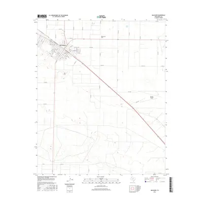
2016 Map of Muleshoe
USGS Topo · Published 2016About this map
Muleshoe serves as the focal point of this High Plains landscape, situated along the diagonal path of the BNSF Railway and W American Blvd. The town's grid is meticulously detailed, extending from the historic Main St through residential avenues and past local institutions including a School and Church. Beyond the town center, the terrain is defined by the broad, subtle depression of Blackwater Draw, a significant paleo-drainage feature of the Llano Estacado. To the northeast, Millen Lake provides a notable hydrologic marker in this semi-arid region. The presence of the Muleshoe Cem and the Muleshoe Municipal Airport southeast of the main settlement highlights the community's established infrastructure and spatial organization during this era of West Texas development.
Find a feature on this map
82 named features on this map. Tap any name to fly to it.
Don’t see what you’re looking for? This feature index may not catch every label — zoom into the map to look around manually.
Map Details
Editions of this 2016 Muleshoe Map
This is the sole edition of this map. No revisions or reprints were ever made.
Other maps of this area

1954 · Clovis
USGS Topo · 1:250,000

1958 · Clovis
USGS Topo · 1:250,000

1962 · Muleshoe
USGS Topo · 1:24,000

1962 · Needmore
USGS Topo · 1:24,000

1962 · Baileyboro NE
USGS Topo · 1:24,000

1962 · Baileyboro
USGS Topo · 1:24,000

1962 · Sudan
USGS Topo · 1:24,000

1962 · Muleshoe NE
USGS Topo · 1:24,000

1963 · Lazbuddie SW
USGS Topo · 1:24,000

1963 · Progress
USGS Topo · 1:24,000