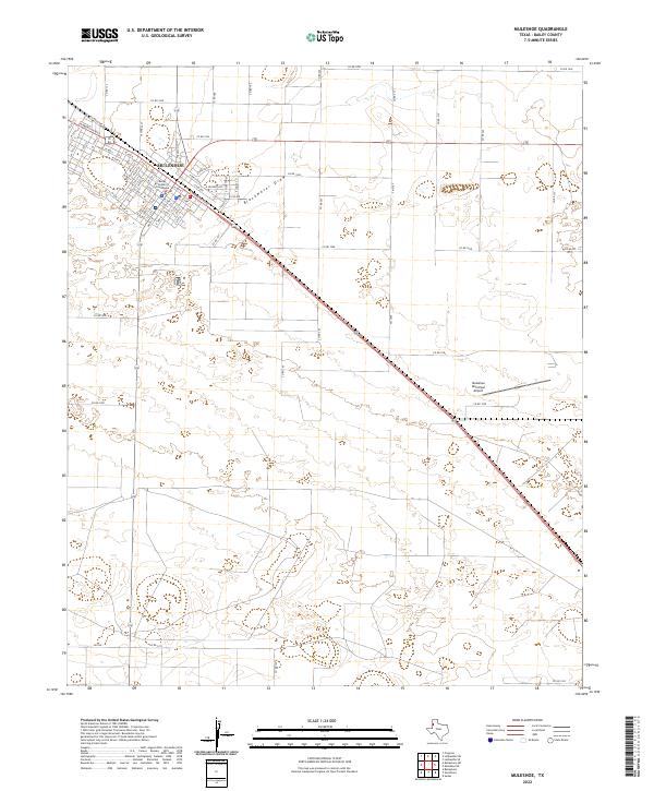
2022 Map of Muleshoe
USGS Topo · Published 2022About this map
Muleshoe serves as the focal point of this High Plains landscape, its grid oriented to the long diagonal of the railroad. The town's administrative heart is anchored by the Bailey County Courthouse, surrounded by a dense network of numbered and lettered streets like W 15th St and W Ave A. Outside the urban center, the geography is defined by the ephemeral path of Blackwater Draw, which meanders southeast across the plains. This drainage feature and the surrounding depressions illustrate the typical hydrology of the Llano Estacado. Transport and commerce follow the corridor of Railroad Ave and the modern thoroughfares of W American Blvd and E American Blvd, while the Muleshoe Municipal Airport marks the eastern edge of the community's infrastructure.
Find a feature on this map
81 named features on this map. Tap any name to fly to it.
Don’t see what you’re looking for? This feature index may not catch every label — zoom into the map to look around manually.
Map Details
Editions of this 2022 Muleshoe Map
This is the sole edition of this map. No revisions or reprints were ever made.
Other maps of this area

1954 · Clovis
USGS Topo · 1:250,000

1958 · Clovis
USGS Topo · 1:250,000

1962 · Muleshoe
USGS Topo · 1:24,000

1962 · Needmore
USGS Topo · 1:24,000

1962 · Baileyboro NE
USGS Topo · 1:24,000

1962 · Baileyboro
USGS Topo · 1:24,000

1962 · Sudan
USGS Topo · 1:24,000

1962 · Muleshoe NE
USGS Topo · 1:24,000

1963 · Lazbuddie SW
USGS Topo · 1:24,000

1963 · Progress
USGS Topo · 1:24,000