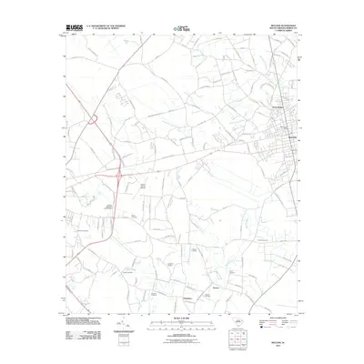
2011 Map of Mullins
USGS Topo · Published 2011About this map
The agrarian landscape of eastern South Carolina is centered here on the hub of Mullins, a region historically defined by its tobacco production and rail access. The map reveals a dense network of rural roads such as Tobacco Barn Rd, reflecting the local agricultural economy. To the north, North Mullins serves as an extension of the primary township, while small rural clusters like Koonce and Pendeboro sit further south among the drainage systems of Little Reedy Creek and Maidendown Swamp.
Find a feature on this map
132 named features on this map. Tap any name to fly to it.
Don’t see what you’re looking for? This feature index may not catch every label — zoom into the map to look around manually.
Map Details
Editions of this 2011 Mullins Map
This is the sole edition of this map. No revisions or reprints were ever made.
Other maps of this area

1943 · Pages Mill
USGS Topo · 1:62,500

1946 · Mullins
USGS Topo · 1:24,000

1947 · Friendship
USGS Topo · 1:24,000

1947 · Marion
USGS Topo · 1:24,000

1947 · Centenary
USGS Topo · 1:24,000

1947 · Mullins
USGS Topo · 1:24,000

1948 · Galivants Ferry
USGS Topo · 1:24,000

1948 · Nichols
USGS Topo · 1:24,000

1950 · Galivants Ferry
USGS Topo · 1:24,000

1950 · Nichols
USGS Topo · 1:24,000