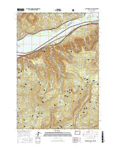
2017 Map of Multnomah Falls
USGS Topo · Published 2017About this map
Multnomah Falls and the dramatic verticality of the Columbia River Gorge dominate this landscape, where the river serves as the state boundary between Oregon and Washington. The northern bank features the Franz Lake National Wildlife Refuge and the slopes of Archer Mtn, while the southern Oregon side is characterized by steep basalt cliffs and famous landmarks. Historic transportation routes are visible along the river, including the Oneonta Tunnel 1759 and the rail lines serving the settlements of Warrendale and Dodson.
Find a feature on this map
66 named features on this map. Tap any name to fly to it.
Don’t see what you’re looking for? This feature index may not catch every label — zoom into the map to look around manually.
Map Details
Editions of this 2017 Multnomah Falls Map
This is the sole edition of this map. No revisions or reprints were ever made.
Other maps of this area

1916 · Estacada
USGS Topo · 1:125,000

1924 · Mount Hood
USGS Topo · 1:125,000

1926 · Hood River
USGS Topo · 1:125,000

1927 · Mount Hood
USGS Topo · 1:125,000

1929 · Hood River
USGS Topo · 1:125,000

1948 · Vancouver
USGS Topo · 1:250,000

1950 · Vancouver
USGS Topo · 1:250,000

1950 · Vancouver
USGS Topo · 1:250,000

1953 · The Dalles
USGS Topo · 1:250,000

1954 · Bridal Veil
USGS Topo · 1:62,500