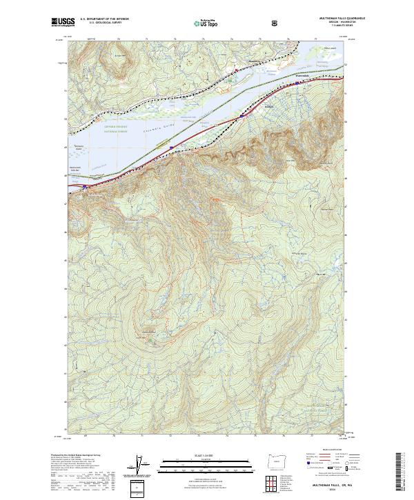
2024 Map of Multnomah Falls
USGS Topo · Published 2024About this map
Multnomah Falls and the dramatic verticality of the Columbia Gorge dominate this 2024 survey, showcasing the geological intensity of the border between Oregon and Washington. The map details a dense network of cascades, including Horsetail Falls, Oneonta Falls, and Wiesendanger Falls, along with the steep climbs to Sherrard Point and Larch Mtn. This modern record captures the preservation of the landscape within the Mark O Hatfield Wilderness and Franz Lake National Wildlife Refuge, where the river’s broad reaches like Broughton Reach and Columbia River Upper Range meet the rugged basalt cliffs.
Find a feature on this map
62 named features on this map. Tap any name to fly to it.
Don’t see what you’re looking for? This feature index may not catch every label — zoom into the map to look around manually.
Map Details
Editions of this 2024 Multnomah Falls Map
This is the sole edition of this map. No revisions or reprints were ever made.
Other maps of this area

1916 · Estacada
USGS Topo · 1:125,000

1924 · Mount Hood
USGS Topo · 1:125,000

1926 · Hood River
USGS Topo · 1:125,000

1927 · Mount Hood
USGS Topo · 1:125,000

1929 · Hood River
USGS Topo · 1:125,000

1948 · Vancouver
USGS Topo · 1:250,000

1950 · Vancouver
USGS Topo · 1:250,000

1950 · Vancouver
USGS Topo · 1:250,000

1953 · The Dalles
USGS Topo · 1:250,000

1954 · Bridal Veil
USGS Topo · 1:62,500