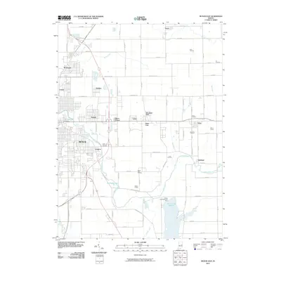
2010 Map of Muncie East
USGS Topo · Published 2010About this map
The White River winds through the eastern suburban and rural reaches of Muncie, defining a landscape where city neighborhoods meet the agricultural outskirts of Delaware County. Residential enclaves such as Morningside, Creston, and Irvington transition into the farming communities of Desoto, Selma, and Smithfield. This 2010 topographic representation shows the significant influence of local water management, anchored by the Prairie Creek Reservoir and the Prairie Creek Reservoir Dam in the southeast corner.
Find a feature on this map
89 named features on this map. Tap any name to fly to it.
Don’t see what you’re looking for? This feature index may not catch every label — zoom into the map to look around manually.
Map Details
Editions of this 2010 Muncie East Map
This is the sole edition of this map. No revisions or reprints were ever made.
Other maps of this area

1952 · Muncie East
USGS Topo · 1:24,000

1952 · Farmland
USGS Topo · 1:24,000

1952 · Muncie West
USGS Topo · 1:24,000

1953 · Muncie
USGS Topo · 1:250,000

1956 · Muncie
USGS Topo · 1:250,000

1960 · Eaton
USGS Topo · 1:24,000

1960 · Mount Pleasant
USGS Topo · 1:24,000

1960 · Wheeling
USGS Topo · 1:24,000

1960 · Sulphur Springs
USGS Topo · 1:24,000
1960 · Modoc
USGS Topo · 1:24,000