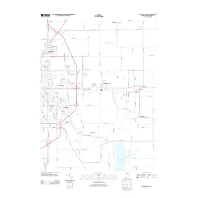
2013 Map of Muncie East
USGS Topo · Published 2013About this map
Prairie Creek Reservoir and the meandering White River dominate the drainage of this East Central Indiana landscape. The area shows a transition from the residential neighborhoods of eastern Muncie, such as Morningside, Creston, and Aultshire, into the fertile agricultural lands of Delaware County. Small rural hubs like Desoto, Selma, and Smithfield are connected by a precise grid of county roads, illustrating the organized expansion of settlement. The infrastructure of the early 21st century is evident in the presence of Reese Airport and several engineered waterways like Hamilton Ditch and Medford Drain. These features reflect a legacy of land management and transportation that has shaped the region's character from its early farming roots into the modern era.
Find a feature on this map
39 named features on this map. Tap any name to fly to it.
Don’t see what you’re looking for? This feature index may not catch every label — zoom into the map to look around manually.
Map Details
Editions of this 2013 Muncie East Map
This is the sole edition of this map. No revisions or reprints were ever made.
Other maps of this area

1952 · Muncie East
USGS Topo · 1:24,000

1952 · Farmland
USGS Topo · 1:24,000

1952 · Muncie West
USGS Topo · 1:24,000

1953 · Muncie
USGS Topo · 1:250,000

1956 · Muncie
USGS Topo · 1:250,000

1960 · Eaton
USGS Topo · 1:24,000

1960 · Mount Pleasant
USGS Topo · 1:24,000

1960 · Wheeling
USGS Topo · 1:24,000

1960 · Sulphur Springs
USGS Topo · 1:24,000
1960 · Modoc
USGS Topo · 1:24,000