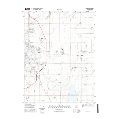
2016 Map of Muncie East
USGS Topo · Published 2016About this map
Muncie and its eastern suburbs dominate this 2016 landscape, revealing the modern footprint of Delaware County's residential and industrial expansion. The city's eastern edge reaches into neighborhoods like Morningside, Aultshire, and Irvington, while the rural character remains intact further east near the settlements of Desoto, Selma, and Smithfield. This transition from urban grid to agricultural township is defined by a complex drainage network, where the White River and its various tributaries, including Hamilton Ditch and Mud Cr, intersect with long-established county roads.
Find a feature on this map
108 named features on this map. Tap any name to fly to it.
Don’t see what you’re looking for? This feature index may not catch every label — zoom into the map to look around manually.
Map Details
Editions of this 2016 Muncie East Map
This is the sole edition of this map. No revisions or reprints were ever made.
Other maps of this area

1952 · Muncie East
USGS Topo · 1:24,000

1952 · Farmland
USGS Topo · 1:24,000

1952 · Muncie West
USGS Topo · 1:24,000

1953 · Muncie
USGS Topo · 1:250,000

1956 · Muncie
USGS Topo · 1:250,000

1960 · Eaton
USGS Topo · 1:24,000

1960 · Mount Pleasant
USGS Topo · 1:24,000

1960 · Wheeling
USGS Topo · 1:24,000

1960 · Sulphur Springs
USGS Topo · 1:24,000
1960 · Modoc
USGS Topo · 1:24,000