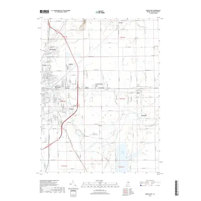
2019 Map of Muncie East
USGS Topo · Published 2019About this map
The White River winds through the heart of Delaware County, connecting the eastern expansion of Muncie with several established satellite communities. To the east, the landscape transitions from the urban neighborhoods of Mayfield and Irvington toward the smaller settlements of Selma and Smithfield. A significant portion of the southeastern quadrant is dominated by the Prairie Creek Reservoir, a major hydrological feature that reshaped the local drainage patterns formerly defined by the Medford Drain and Carmichael Ditch.
Find a feature on this map
105 named features on this map. Tap any name to fly to it.
Don’t see what you’re looking for? This feature index may not catch every label — zoom into the map to look around manually.
Map Details
Editions of this 2019 Muncie East Map
This is the sole edition of this map. No revisions or reprints were ever made.
Other maps of this area

1952 · Muncie East
USGS Topo · 1:24,000

1952 · Farmland
USGS Topo · 1:24,000

1952 · Muncie West
USGS Topo · 1:24,000

1953 · Muncie
USGS Topo · 1:250,000

1956 · Muncie
USGS Topo · 1:250,000

1960 · Eaton
USGS Topo · 1:24,000

1960 · Mount Pleasant
USGS Topo · 1:24,000

1960 · Wheeling
USGS Topo · 1:24,000

1960 · Sulphur Springs
USGS Topo · 1:24,000
1960 · Modoc
USGS Topo · 1:24,000