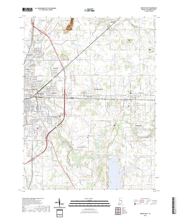
2022 Map of Muncie East
USGS Topo · Published 2022About this map
The White River and its accompanying wetlands dominate this eastern Delaware County landscape, carving a path through the suburbs and farmland surrounding Muncie. Significant water features like the Prairie Creek Reservoir and Burlington Lake highlight the area's modern hydraulic management, while the Cardinal Greenway Trl follows the route of a former rail corridor, serving as a recreational spine through Mayfield and Irvington. Local history is preserved through a high density of small cemeteries, including Graham National Cem, Parker Moore Cem, and the Sparr Cem near Desoto. The map shows a clear transition from the urban grid of Muncie's eastern neighborhoods, such as Morningside and Creston, to the smaller outlying settlements of Selma and Smithfield, illustrating the continued expansion of the county seat toward its rural neighbors.
Find a feature on this map
70 named features on this map. Tap any name to fly to it.
Don’t see what you’re looking for? This feature index may not catch every label — zoom into the map to look around manually.
Map Details
Editions of this 2022 Muncie East Map
This is the sole edition of this map. No revisions or reprints were ever made.
Other maps of this area

1952 · Muncie East
USGS Topo · 1:24,000

1952 · Farmland
USGS Topo · 1:24,000

1952 · Muncie West
USGS Topo · 1:24,000

1953 · Muncie
USGS Topo · 1:250,000

1956 · Muncie
USGS Topo · 1:250,000

1960 · Eaton
USGS Topo · 1:24,000

1960 · Mount Pleasant
USGS Topo · 1:24,000

1960 · Wheeling
USGS Topo · 1:24,000

1960 · Sulphur Springs
USGS Topo · 1:24,000
1960 · Modoc
USGS Topo · 1:24,000