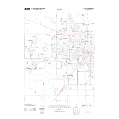
2013 Map of Muncie West
USGS Topo · Published 2013About this map
The White River and its numerous tributaries, including Buck Cr and York Prairie Cr, define the drainage and development patterns west of Muncie during this 2013 survey. The urban expansion of the city is evident as it transitions toward neighboring communities like Yorktown, West Muncie, and Andersonville. The map illustrates a landscape shaped by both suburban residential growth and significant institutional footprints, notably the John B and June M Scheumann Stadium and the Delaware County Regional Airport.
Find a feature on this map
125 named features on this map. Tap any name to fly to it.
Don’t see what you’re looking for? This feature index may not catch every label — zoom into the map to look around manually.
Map Details
Editions of this 2013 Muncie West Map
This is the sole edition of this map. No revisions or reprints were ever made.
Other maps of this area

1952 · Muncie East
USGS Topo · 1:24,000

1952 · Muncie West
USGS Topo · 1:24,000

1953 · Muncie
USGS Topo · 1:250,000

1956 · Muncie
USGS Topo · 1:250,000

1960 · Gilman
USGS Topo · 1:24,000

1960 · Middletown
USGS Topo · 1:24,000

1960 · Eaton
USGS Topo · 1:24,000

1960 · Mount Pleasant
USGS Topo · 1:24,000

1960 · Wheeling
USGS Topo · 1:24,000

1960 · Sulphur Springs
USGS Topo · 1:24,000