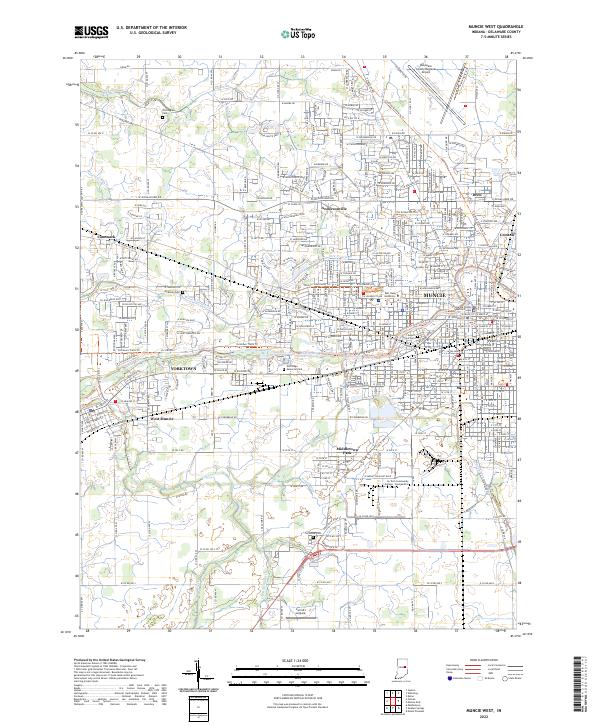
2022 Map of Muncie West
USGS Topo · Published 2022About this map
Ball State University and the western reaches of Muncie dominate this 2022 survey, illustrating the modern educational and residential footprint of Delaware County. The landscape is defined by the White River and its various tributaries, including York Prairie Creek and Buck Creek, which historically shaped the settlement patterns of towns like Yorktown and Cammack. Local heritage is preserved in numerous burial grounds such as Nottingham Cemetery and McKinley Cemetery, while the presence of the Delaware County Regional Airport and Ivy Tech Community College - East-Central speaks to the region's contemporary infrastructure. Notable recreation and transit corridors, including the Cardinal Greenway Trail, reflect the repurposing of the area's rail history for modern public use.
Find a feature on this map
313 named features on this map. Tap any name to fly to it.
Don’t see what you’re looking for? This feature index may not catch every label — zoom into the map to look around manually.
Map Details
Editions of this 2022 Muncie West Map
This is the sole edition of this map. No revisions or reprints were ever made.
Other maps of this area

1952 · Muncie East
USGS Topo · 1:24,000

1952 · Muncie West
USGS Topo · 1:24,000

1953 · Muncie
USGS Topo · 1:250,000

1956 · Muncie
USGS Topo · 1:250,000

1960 · Gilman
USGS Topo · 1:24,000

1960 · Middletown
USGS Topo · 1:24,000

1960 · Eaton
USGS Topo · 1:24,000

1960 · Mount Pleasant
USGS Topo · 1:24,000

1960 · Wheeling
USGS Topo · 1:24,000

1960 · Sulphur Springs
USGS Topo · 1:24,000