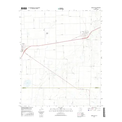
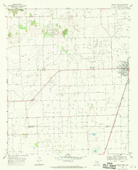
2016 Map of Munday East
USGS Topo · Published 2016About this map
Goree and the eastern edge of Munday anchor this 2016 survey of the Rolling Plains region. The landscape is defined by a grid of county roads and agricultural plots, punctuated by the Munday Municipal Airport and the seasonal drainages of Wild Horse Cr and Lake Cr. Significant for genealogists and local historians are the two distinct burial grounds north of Goree: the newer Goree Cem and the more remote Old Goree Cem, which speak to the long-standing settlement of this Knox County community. Small water bodies like Scott Lake and Munday Park Lake provide rare hydrologic markers in an otherwise semi-arid terrain. The southern portion of the map is bisected by the Knox Co Haskell Co line, showing the intersection of rural infrastructure across these two North Texas counties.
Find a feature on this map
59 named features on this map. Tap any name to fly to it.
Don’t see what you’re looking for? This feature index may not catch every label — zoom into the map to look around manually.
Map Details
Editions of this 2016 Munday East Map
This is the sole edition of this map. No revisions or reprints were ever made.
Other maps of this area

1954 · Wichita Falls
USGS Topo · 1:250,000

1958 · Wichita Falls
USGS Topo · 1:250,000
1962 · Antelope Creek SW
USGS Topo · 1:24,000
1962 · Antelope Creek NW
USGS Topo · 1:24,000
1966 · Bomarton
USGS Topo · 1:24,000
1967 · Hefner
USGS Topo · 1:24,000
1967 · Weinert
USGS Topo · 1:24,000
1967 · Rhineland
USGS Topo · 1:24,000
1967 · Mattson
USGS Topo · 1:24,000
1968 · Munday West
USGS Topo · 1:24,000