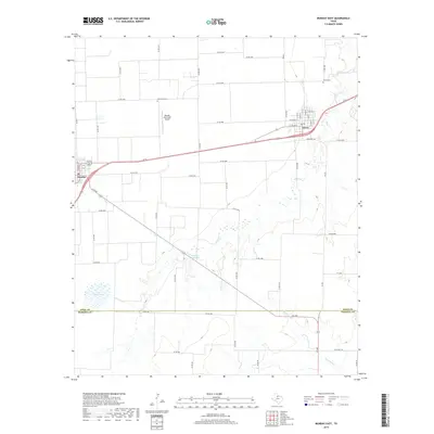
2019 Map of Munday East
USGS Topo · Published 2019About this map
Agricultural lands along the Knox Co and Haskell Co line characterize this landscape in north-central Texas. The small city of Munday sits at the western edge of the survey area, while Goree serves as a hub to the east. The region's history is reflected in the presence of both the Goree Cem and the Old Goree Cem, providing valuable points of interest for genealogical research. The Munday Municipal Airport occupies a central position between these two settlements, highlighting the modern infrastructure supporting this rural community.
Find a feature on this map
62 named features on this map. Tap any name to fly to it.
Don’t see what you’re looking for? This feature index may not catch every label — zoom into the map to look around manually.
Map Details
Editions of this 2019 Munday East Map
This is the sole edition of this map. No revisions or reprints were ever made.
Other maps of this area

1954 · Wichita Falls
USGS Topo · 1:250,000

1958 · Wichita Falls
USGS Topo · 1:250,000

1962 · Antelope Creek SW
USGS Topo · 1:24,000

1962 · Antelope Creek NW
USGS Topo · 1:24,000

1966 · Bomarton
USGS Topo · 1:24,000

1967 · Hefner
USGS Topo · 1:24,000

1967 · Weinert
USGS Topo · 1:24,000

1967 · Rhineland
USGS Topo · 1:24,000

1967 · Mattson
USGS Topo · 1:24,000

1968 · Munday West
USGS Topo · 1:24,000