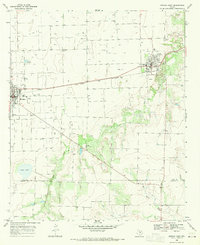
1968 Map of Munday East
USGS Topo · Published 1970About this map
Agricultural plains meet the rising energy economy in this late 1960s study of the Knox and Haskell County line. The landscape is defined by a dense grid of Oil Wells and a sprawling Oil Field, particularly concentrated south of Goree (BM 1457). This period finds the region well-connected by the Fort Worth and Denver railroad, which bisects the quadrangle and links the primary settlements.
Find a feature on this map
22 named features on this map. Tap any name to fly to it.
Don’t see what you’re looking for? This feature index may not catch every label — zoom into the map to look around manually.
Map Details
Editions of this 1968 Munday East Map
This is the sole edition of this map. No revisions or reprints were ever made.
Other maps of this area

1954 · Wichita Falls
USGS Topo · 1:250,000

1958 · Wichita Falls
USGS Topo · 1:250,000

1962 · Antelope Creek SW
USGS Topo · 1:24,000

1962 · Antelope Creek NW
USGS Topo · 1:24,000

1966 · Bomarton
USGS Topo · 1:24,000

1967 · Hefner
USGS Topo · 1:24,000

1967 · Weinert
USGS Topo · 1:24,000

1967 · Rhineland
USGS Topo · 1:24,000

1967 · Mattson
USGS Topo · 1:24,000

1968 · Munday West
USGS Topo · 1:24,000