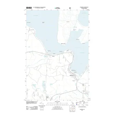
2011 Map of Munising
USGS Topo · Published 2011About this map
Grand Island dominates the northern reaches of this coastal survey, separated from the mainland by the waters of Grand Island Harbor Bay and South Bay. The southern shore of Lake Superior is defined by a series of maritime landmarks and small settlements, including Munising, Christmas, and the rail-oriented Munising Junction. Along the coast, the Munising Front and Rear Range Lighthouse and the Bay Furnace Lighthouse once guided vessels into the harbor, supporting the local economy centered around the Munising City Dock.
Find a feature on this map
64 named features on this map. Tap any name to fly to it.
Don’t see what you’re looking for? This feature index may not catch every label — zoom into the map to look around manually.
Map Details
Editions of this 2011 Munising Map
This is the sole edition of this map. No revisions or reprints were ever made.
Other maps of this area

1931 · Munising SE
USGS Topo · 1:31,680

1958 · Munising
USGS Topo · 1:62,500

1958 · Au Train
USGS Topo · 1:62,500

1958 · Wood Island
USGS Topo · 1:62,500

1958 · Marquette
USGS Topo · 1:250,000

1960 · Marquette
USGS Topo · 1:250,000

1961 · Marquette
USGS Topo · 1:250,000

1968 · Marquette
USGS Topo · 1:250,000

1983 · Munising
USGS Topo · 1:100,000
1984 · Au Sable Point
USGS Topo · 1:100,000