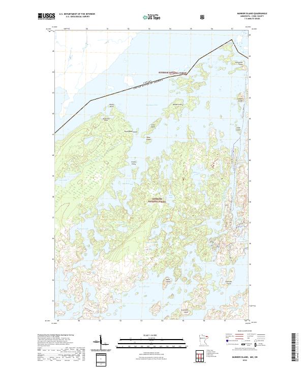
2022 Map of Munker Island
USGS Topo · Published 2022About this map
The international border between the Canada United States of America divides this water-dominated landscape, where the northern reaches of the Superior National Forest meet the Canadian wilderness. Modern recreation and legacy travel routes are centered around Saganaga Lake and Sea Gull Lake, connected by the historic Gunflint Trail and the Sea Gull River. The map details a labyrinth of islands and peninsulas, including Munker Island, Englishman Island, and American Point, illustrating the complex glacial geography of Minnesota's Arrowhead region. Inland from the larger lakes, a network of smaller basins such as Hivernant Lake and Grandpa Lake are accessible via specialized paths like the Sag Corridor Water Trail and the Alpine-Seagull Trail. This area represents a preserved corridor of the north woods, where transport is defined by portages and water routes rather than traditional road networks.
Find a feature on this map
47 named features on this map. Tap any name to fly to it.
Don’t see what you’re looking for? This feature index may not catch every label — zoom into the map to look around manually.
Map Details
Editions of this 2022 Munker Island Map
This is the sole edition of this map. No revisions or reprints were ever made.
Other maps of this area

1957 · Quetico
USGS Topo · 1:250,000

1959 · Munker Island
USGS Topo · 1:24,000

1959 · Conners Island
USGS Topo · 1:24,000

1959 · Ogishkemuncie Lake
USGS Topo · 1:24,000

1959 · Gillis Lake
USGS Topo · 1:24,000

1959 · Ester Lake
USGS Topo · 1:24,000
1960 · Long Island Lake
USGS Topo · 1:24,000

1968 · Quetico
USGS Topo · 1:250,000

1976 · Saganaga Lake
USGS Topo · 1:100,000

1977 · Basswood Lake
USGS Topo · 1:100,000