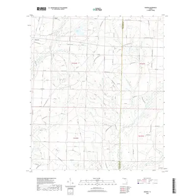
2018 Map of Munson
USGS Topo · Published 2018About this map
Munson sits at the heart of this landscape in the western Florida Panhandle, where the terrain is defined by a dense network of blackwater streams and timberlands. The Blackwater River winds through the eastern portion of the survey, fed by numerous tributaries such as Beaver Creek, Lighter Knot Cr, and Penny Cr. Local history is anchored by the Ates Cem and family-named landmarks like Martins Mill Pond, which suggest the area's agricultural and milling heritage. The presence of Blackwater Airfield and the winding Florida National Scenic Trail reflects the modern intersection of aviation and recreation within the surrounding forest. A system of forest roads and trails, including State Forest Rd and Krul Lake Rd, provides access across the shifting elevations of Santa Rosa and Okaloosa counties. This survey preserves the geography of the region as it transitioned from traditional rural uses toward protected recreation areas like Bear Lake.
Find a feature on this map
70 named features on this map. Tap any name to fly to it.
Don’t see what you’re looking for? This feature index may not catch every label — zoom into the map to look around manually.
Map Details
Editions of this 2018 Munson Map
This is the sole edition of this map. No revisions or reprints were ever made.
Other maps of this area

1934 · Holt
USGS Topo · 1:48,000

1934 · Harold
USGS Topo · 1:62,500

1937 · Holt
USGS Topo · 1:62,500

1937 · Harold
USGS Topo · 1:62,500

1938 · Harold
USGS Topo · 1:62,500

1948 · Munson
USGS Topo · 1:62,500

1949 · Crestview
USGS Topo · 1:62,500

1950 · Munson
USGS Topo · 1:62,500

1951 · Crestview
USGS Topo · 1:62,500

1956 · Holt
USGS Topo · 1:62,500