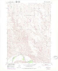
1951 Map of Murdo SE
USGS Topo · Published 1979About this map
The White River flows along the southern edge of this Jones and Mellette County landscape, defining the boundary between township districts. This 1951 survey, with 1970s revisions, illustrates a remote prairie environment characterized by the complex drainage systems of Bull Creek and Spring Creek. The terrain is divided into named regions such as Buffalo, Dunkel, and Westover, reflecting the early administrative or ranching divisions of the South Dakota interior. To the south, Zickrick and Cody border the river’s floodplain. Researchers will find a landscape primarily defined by its hydrology, with Johnny Creek cutting through the western sections. The map serves as a detailed record of the Missouri River Basin development program, showing the topography of the land before modern intensive infrastructure altered the original drainage patterns of these semi-arid plains.
Find a feature on this map
10 named features on this map. Tap any name to fly to it.
Don’t see what you’re looking for? This feature index may not catch every label — zoom into the map to look around manually.
Map Details
Editions of this 1951 Murdo SE Map
2 editions found
Other maps of this area

1951 · Murdo SE
USGS Topo · 1:24,000

1951 · White River NE
USGS Topo · 1:24,000

1951 · Westover
USGS Topo · 1:24,000

1951 · Badnation NW
USGS Topo · 1:24,000

1951 · Murdo SW
USGS Topo · 1:24,000

1955 · Martin
USGS Topo · 1:250,000

1958 · Martin
USGS Topo · 1:250,000

1970 · Vivian SW
USGS Topo · 1:24,000

1972 · Draper
USGS Topo · 1:24,000

1972 · Murdo
USGS Topo · 1:24,000