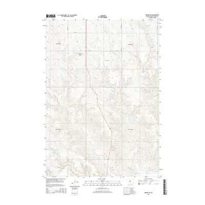
2015 Map of Murdo SW
USGS Topo · Published 2015About this map
Murdo Municipal Airport sits on a plateau in the northwestern reaches of this Jones County landscape, overlooking a series of drainage networks that define the local topography. This 2015 survey reveals an environment shaped by intermittent watercourses like Horse Cr and Hay Cr, which carve through the plains. The map illustrates a grid of rural infrastructure, including 244th St and 245th St, facilitating access to the agricultural holdings and open range south of Murdo. Numerous smaller tributaries, such as Johnny Cr, E Fork Hay Cr, and W Fork Hay Cr, flow toward the larger basins, indicating the natural drainage patterns of this Great Plains region during the mid-2010s. The presence of Larson Pl and CR-56 in the south provides specific reference points for researchers tracking property boundaries and local road developments in this part of South Dakota.
Find a feature on this map
16 named features on this map. Tap any name to fly to it.
Don’t see what you’re looking for? This feature index may not catch every label — zoom into the map to look around manually.
Map Details
Editions of this 2015 Murdo SW Map
This is the sole edition of this map. No revisions or reprints were ever made.
Other maps of this area

1951 · Murdo SE
USGS Topo · 1:24,000

1951 · White River NE
USGS Topo · 1:24,000

1951 · Westover
USGS Topo · 1:24,000

1951 · Murdo SW
USGS Topo · 1:24,000

1951 · Murdo 3 NE
USGS Topo · 1:24,000

1951 · Okaton SE
USGS Topo · 1:24,000

1955 · Martin
USGS Topo · 1:250,000

1958 · Martin
USGS Topo · 1:250,000

1972 · Draper
USGS Topo · 1:24,000

1972 · Murdo
USGS Topo · 1:24,000