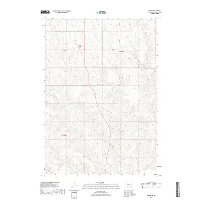
2017 Map of Murdo SW
USGS Topo · Published 2017About this map
Murdo Municipal Airport serves as a lone modern landmark in this expansive reach of Jones County, where the topography is defined by the dendritic drainage patterns of the White River watershed. The landscape is carved by numerous seasonal watercourses, including Horse Creek and Ash Creek, which wind through the south, while the northern sections are shaped by the convergence of W Fork Hay Creek and E Fork Hay Creek. This 2017 survey illustrates the persistent rural character of the Great Plains, where section lines and local routes like County Road 56 provide the primary framework for navigation across the undulating terrain. The detailed contour intervals reveal the intricate network of draws and ridges that characterize this part of South Dakota, offering a precise look at the land's natural contours before they merge into the larger Hay Creek system.
Find a feature on this map
15 named features on this map. Tap any name to fly to it.
Don’t see what you’re looking for? This feature index may not catch every label — zoom into the map to look around manually.
Map Details
Editions of this 2017 Murdo SW Map
This is the sole edition of this map. No revisions or reprints were ever made.
Other maps of this area

1951 · Murdo SE
USGS Topo · 1:24,000

1951 · White River NE
USGS Topo · 1:24,000

1951 · Westover
USGS Topo · 1:24,000

1951 · Murdo SW
USGS Topo · 1:24,000

1951 · Murdo 3 NE
USGS Topo · 1:24,000

1951 · Okaton SE
USGS Topo · 1:24,000

1955 · Martin
USGS Topo · 1:250,000

1958 · Martin
USGS Topo · 1:250,000

1972 · Draper
USGS Topo · 1:24,000

1972 · Murdo
USGS Topo · 1:24,000