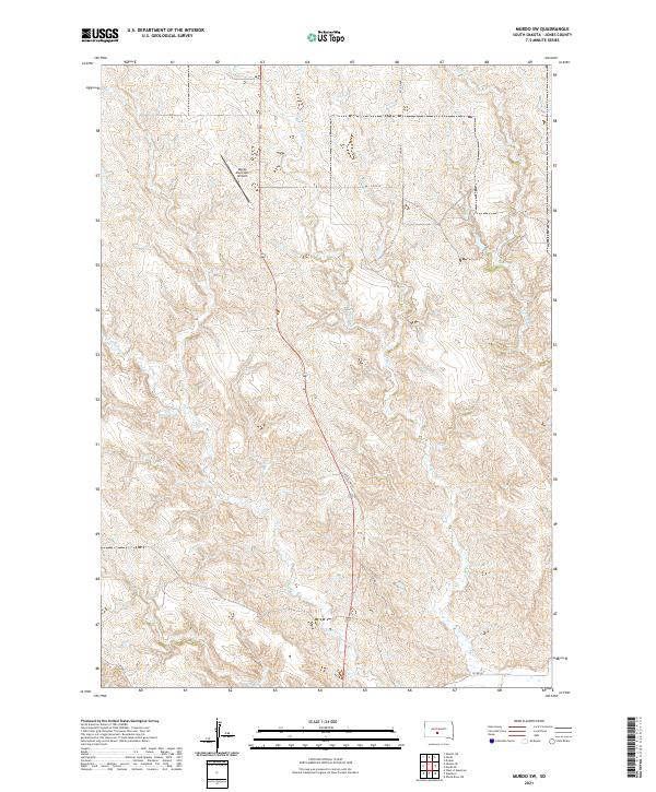
2021 Map of Murdo SW
USGS Topo · Published 2021About this map
The Murdo Municipal Airport serves as a modern landmark in this prairie landscape of central South Dakota, situated just southwest of the town of Murdo. The terrain is defined by the intricate branching of local waterways, including Johnny Cr and the multiple tributaries of Hay Cr. These drainages create a series of subtle ridges and valleys typical of the High Plains, where ranching and local travel depend on a network of section-line roads and former thoroughfares like Old US Hwy 83.
Find a feature on this map
17 named features on this map. Tap any name to fly to it.
Don’t see what you’re looking for? This feature index may not catch every label — zoom into the map to look around manually.
Map Details
Editions of this 2021 Murdo SW Map
This is the sole edition of this map. No revisions or reprints were ever made.
Other maps of this area

1951 · Murdo SE
USGS Topo · 1:24,000

1951 · White River NE
USGS Topo · 1:24,000

1951 · Westover
USGS Topo · 1:24,000

1951 · Murdo SW
USGS Topo · 1:24,000

1951 · Murdo 3 NE
USGS Topo · 1:24,000

1951 · Okaton SE
USGS Topo · 1:24,000

1955 · Martin
USGS Topo · 1:250,000

1958 · Martin
USGS Topo · 1:250,000

1972 · Draper
USGS Topo · 1:24,000

1972 · Murdo
USGS Topo · 1:24,000