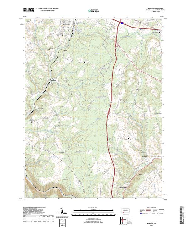
2023 Map of Murdock
USGS Topo · Published 2023About this map
Somerset borders the northern edge of this Pennsylvania landscape, where the waters of Coxes Creek and Kimberly Run begin their descent through the highlands. The terrain is characterized by the prominent rise of Negro Mountain to the southwest and Cover Hill to the northeast, creating a complex series of ridges and valleys. Small settlements like Beachdale, Blackfield, and Shamrock are connected by a network of rural routes, including the legacy thoroughfare of E Mud Pike Rd.
Find a feature on this map
111 named features on this map. Tap any name to fly to it.
Don’t see what you’re looking for? This feature index may not catch every label — zoom into the map to look around manually.
Map Details
Editions of this 2023 Murdock Map
This is the sole edition of this map. No revisions or reprints were ever made.
Other maps of this area

1913 · Somerset
USGS Topo · 1:62,500

1914 · Windber
USGS Topo · 1:62,500

1915 · Somerset
USGS Topo · 1:62,500

1916 · Windber
USGS Topo · 1:62,500

1921 · Meyersdale
USGS Topo · 1:62,500

1923 · Berlin
USGS Topo · 1:48,000

1929 · Berlin
USGS Topo · 1:62,500

1939 · Meyersdale
USGS Topo · 1:62,500

1944 · Somerset
USGS Topo · 1:62,500

1944 · Windber
USGS Topo · 1:62,500