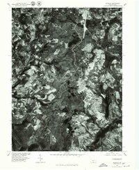
1977 Map of Murdock
USGS Topo · Published 1979About this map
Somerset anchors the northern edge of this orthophoto map, which reveals the complex patchwork of the late 1970s Pennsylvania landscape. The high-altitude aerial imagery, rectified by automatic correlation, provides a unique view of the agricultural and industrial patterns surrounding the Casselman River. Smaller settlements like Beachdale, Burkholder, and Murdock are visible as clusters amidst the rugged topography. The imagery clearly distinguishes between the dense forested tracts and the geometric shapes of cleared farmland and mining activity. In the west, Wilson Creek and the meandering path of Coxes define the drainage of this Somerset County terrain. This document, produced in cooperation with the Soil Conservation Service, serves as a precise record of land use and rural development before the expansion of more modern infrastructure.
Find a feature on this map
7 named features on this map. Tap any name to fly to it.
Don’t see what you’re looking for? This feature index may not catch every label — zoom into the map to look around manually.
Map Details
Editions of this 1977 Murdock Map
This is the sole edition of this map. No revisions or reprints were ever made.
Other maps of this area

1913 · Somerset
USGS Topo · 1:62,500

1914 · Windber
USGS Topo · 1:62,500

1915 · Somerset
USGS Topo · 1:62,500

1916 · Windber
USGS Topo · 1:62,500

1921 · Meyersdale
USGS Topo · 1:62,500

1923 · Berlin
USGS Topo · 1:48,000

1929 · Berlin
USGS Topo · 1:62,500

1939 · Meyersdale
USGS Topo · 1:62,500

1944 · Somerset
USGS Topo · 1:62,500

1944 · Windber
USGS Topo · 1:62,500