
1957 Map of Murphy
USGS Topo · Published 1958About this map
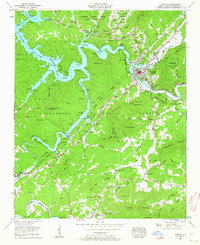
Murphy serves as the focal point of this mid-century Western North Carolina landscape, situated at the confluence of the Hiwassee River and the Nottely River. The map captures the area following the creation of Hiwassee Lake, showing the submerged river valleys and the complex shoreline that includes Ramsey Bend and Die Bend. The region's indigenous history is distinctly marked by the Cherokee Indian Land Donation and Cherokee Indian Land Tract No 2, while the industrial character is evidenced by several Talc mines and the Southern railroad line. Deep in the Nantahala National Forest, rural life is anchored by family-named landmarks and local institutions like Mt Liberty Ch and Snow Hill Ch. The topography is defined by significant elevations such as Panther Top and Fort Butler Mtn, reflecting the transition from valley floor to steep ridges.
Find a feature on this map
109 named features on this map. Tap any name to fly to it.
Don’t see what you’re looking for? This feature index may not catch every label — zoom into the map to look around manually.
Map Details
Editions of this 1957 Murphy Map
4 editions found
Other maps of this area

1886 · Dahlonega
USGS Topo · 1:125,000

1888 · Ellijay
USGS Topo · 1:125,000

1892 · Dahlonega
USGS Topo · 1:125,000

1892 · Ellijay
USGS Topo · 1:125,000

1893 · Murphy
USGS Topo · 1:125,000

1896 · Dahlonega
USGS Topo · 1:125,000

1898 · Ellijay
USGS Topo · 1:125,000

1903 · Dahlonega
USGS Topo · 1:125,000

1911 · Ellijay
USGS Topo · 1:125,000

1914 · Murphy
USGS Topo · 1:125,000