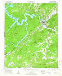
1957 Map of Murphy
USGS Topo · Published 1963About this map
Murphy serves as the focal point of this mid-century survey, situated at the confluence of the Hiwassee River and the Valley Mountain foothills. The town is depicted with its growing infrastructure, including the Murphy High Sch, an Athletic Field, and the L&N RR corridors. Surrounding the valley, the Nantahala National Forest covers high ground like Fort Butler Mtn and Wildcat Mountain, where a Lookout tower stands on Panther Top.
Find a feature on this map
99 named features on this map. Tap any name to fly to it.
Don’t see what you’re looking for? This feature index may not catch every label — zoom into the map to look around manually.
Map Details
Editions of this 1957 Murphy Map
4 editions found

Other maps of this area

1886 · Dahlonega
USGS Topo · 1:125,000

1888 · Ellijay
USGS Topo · 1:125,000

1892 · Dahlonega
USGS Topo · 1:125,000

1892 · Ellijay
USGS Topo · 1:125,000

1893 · Murphy
USGS Topo · 1:125,000

1896 · Dahlonega
USGS Topo · 1:125,000

1898 · Ellijay
USGS Topo · 1:125,000

1903 · Dahlonega
USGS Topo · 1:125,000

1911 · Ellijay
USGS Topo · 1:125,000

1914 · Murphy
USGS Topo · 1:125,000