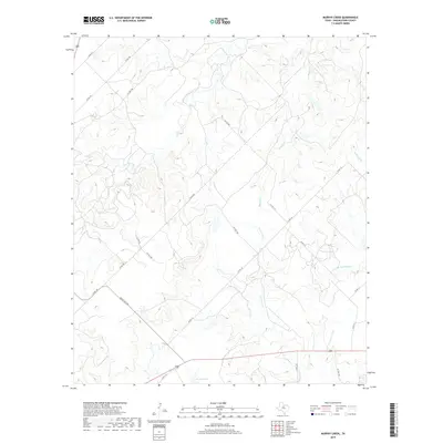
2019 Map of Murphy Creek
USGS Topo · Published 2019About this map
Stasney Lake serves as a primary water landmark in this pocket of Shackelford County, where the landscape is defined by an intricate network of seasonal drainage and creek beds. The terrain is bisected by numerous watercourses including Murphy Cr, Newcomb Cr, and McDowell Cr, along with its southern tributary, S Br McDowell Cr. These waterways dictate the local topography, creating a series of draws and ridges that have historically influenced land use and the placement of cattle guards and ranching infrastructure.
Find a feature on this map
24 named features on this map. Tap any name to fly to it.
Don’t see what you’re looking for? This feature index may not catch every label — zoom into the map to look around manually.
Map Details
Editions of this 2019 Murphy Creek Map
This is the sole edition of this map. No revisions or reprints were ever made.
Other maps of this area

1892 · Albany
USGS Topo · 1:125,000

1893 · Albany
USGS Topo · 1:125,000

1954 · Abilene
USGS Topo · 1:250,000

1958 · Abilene
USGS Topo · 1:250,000

1958 · Edwards Branch
USGS Topo · 1:24,000

1961 · Eolian
USGS Topo · 1:24,000

1965 · Collins Creek
USGS Topo · 1:24,000

1965 · Albany
USGS Topo · 1:24,000

1965 · McCatherine Mountain
USGS Topo · 1:24,000

1965 · Lusk
USGS Topo · 1:24,000