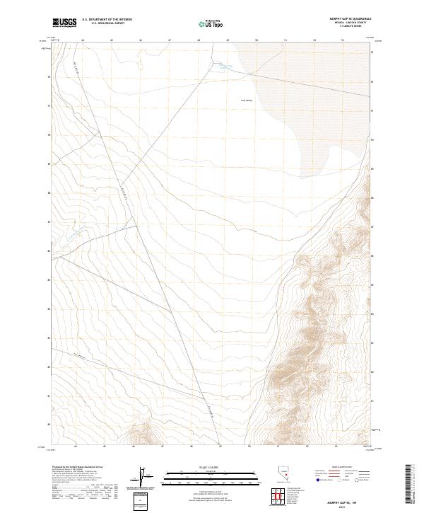
2021 Map of Murphy Gap SE
USGS Topo · Published 2021About this map
Coal Valley dominates the high-desert landscape in this Lincoln County survey, illustrating the vast, unpopulated basin-and-range topography typical of southeastern Nevada. The area is defined by the ephemeral water systems of Cold Springs Wash and the Murphy Gap Reservoir, which collect seasonal runoff from the surrounding mountain gaps. Human presence is limited to the foundational infrastructure of the Public Land Survey System and the long, solitary transit line of Mail Summit Rd, which traverses the arid terrain. This map captures the region in its modern state, serving as a record of the enduring desert ecology and the sparse network of tracks that connect these isolated valley reaches.
Find a feature on this map
8 named features on this map. Tap any name to fly to it.
Don’t see what you’re looking for? This feature index may not catch every label — zoom into the map to look around manually.
Map Details
Editions of this 2021 Murphy Gap SE Map
This is the sole edition of this map. No revisions or reprints were ever made.
Other maps of this area

1954 · Caliente
USGS Topo · 1:250,000

1959 · Caliente
USGS Topo · 1:250,000

1970 · Oreana Spring
USGS Topo · 1:24,000

1970 · Seaman Wash
USGS Topo · 1:24,000

1970 · Fossil Peak
USGS Topo · 1:24,000

1985 · Mail Summit
USGS Topo · 1:24,000
1985 · Mount Irish
USGS Topo · 1:24,000

1985 · Coal Valley Reservoir
USGS Topo · 1:24,000

1985 · Murphy Gap
USGS Topo · 1:24,000

1985 · Murphy Gap NW
USGS Topo · 1:24,000