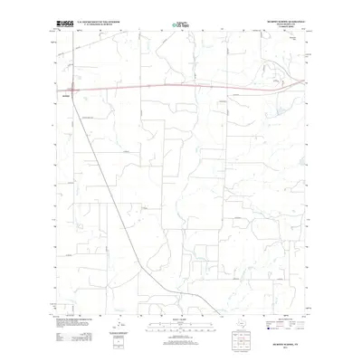
2013 Map of Murphy School
USGS Topo · Published 2013About this map
The eastern edges of Hondo anchor this landscape, where the urban grid gives way to the drainage networks of Medina County. The terrain is defined by a series of south-flowing waterways, most notably Hondo Cr and the braided path of Elm Slough, which dominate the central and western sections. To the northeast, the topography rises toward Schmidt Hill, the most prominent elevation in an otherwise gently sloping agricultural and ranching expanse.
Find a feature on this map
35 named features on this map. Tap any name to fly to it.
Don’t see what you’re looking for? This feature index may not catch every label — zoom into the map to look around manually.
Map Details
Editions of this 2013 Murphy School Map
This is the sole edition of this map. No revisions or reprints were ever made.
Other maps of this area

1942 · Natalia
USGS Topo · 1:62,500

1954 · San Antonio
USGS Topo · 1:250,000

1956 · New Fountain
USGS Topo · 1:62,500

1957 · San Antonio
USGS Topo · 1:250,000

1964 · Riomedina
USGS Topo · 1:24,000

1964 · Castroville
USGS Topo · 1:24,000

1964 · Devine
USGS Topo · 1:24,000
1964 · Biry
USGS Topo · 1:24,000

1964 · Yancey
USGS Topo · 1:24,000
1969 · Quihi
USGS Topo · 1:24,000