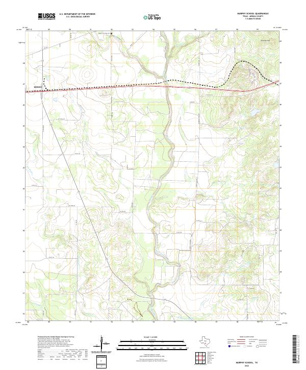
2022 Map of Murphy School
USGS Topo · Published 2022About this map
The agrarian landscape of Medina County unfolds across this 2022 survey, centered on the drainage networks that feed the region's agricultural vitality. The Masonic Springs Cem sits at the northern edge of the map, serving as a significant genealogical marker for local families. The eastern boundary of Hondo is visible where Highway 90 bisects the terrain, illustrating the modern footprint of this regional hub. The hydrology of the area is particularly complex, defined by the winding course of Hondo Creek and seasonal features like Hog Wallow Slough and Elm Slough. To the northeast, the elevation rises toward Schmidt Hill, providing a topographical break from the creek bottoms. This modern USGS study meticulously details the intricate network of county roads, such as Lower Elstone Rd and Paige Rd, which connect the dispersed farmsteads and ranchlands that characterize this portion of Texas.
Find a feature on this map
36 named features on this map. Tap any name to fly to it.
Don’t see what you’re looking for? This feature index may not catch every label — zoom into the map to look around manually.
Map Details
Editions of this 2022 Murphy School Map
This is the sole edition of this map. No revisions or reprints were ever made.
Other maps of this area

1942 · Natalia
USGS Topo · 1:62,500

1954 · San Antonio
USGS Topo · 1:250,000

1956 · New Fountain
USGS Topo · 1:62,500

1957 · San Antonio
USGS Topo · 1:250,000

1964 · Riomedina
USGS Topo · 1:24,000

1964 · Castroville
USGS Topo · 1:24,000

1964 · Devine
USGS Topo · 1:24,000
1964 · Biry
USGS Topo · 1:24,000

1964 · Yancey
USGS Topo · 1:24,000
1969 · Quihi
USGS Topo · 1:24,000