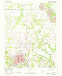
1968 Map of Murphysboro
USGS Topo · Published 1978About this map
Murphysboro serves as the focal point of this Jackson County survey, situated at the intersection of significant rail lines and the winding Big Muddy River. The urban grid is densely detailed with landmarks such as the Courthouse, Hospital, and several local schools like Douglas Sch and Lincoln Sch. The landscape surrounding the city is defined by the sharp meanders of Beaucoup Creek as it flows south toward the river, passing near the Harrison settlement and the rural Pate Chapel.
Find a feature on this map
59 named features on this map. Tap any name to fly to it.
Don’t see what you’re looking for? This feature index may not catch every label — zoom into the map to look around manually.
Map Details
Editions of this 1968 Murphysboro Map
3 editions found
Other maps of this area

1910 · Herrin
USGS Topo · 1:62,500

1910 · Murphysboro
USGS Topo · 1:62,500

1922 · Carbondale
USGS Topo · 1:62,500

1924 · Alto Pass
USGS Topo · 1:62,500

1936 · Herrin
USGS Topo · 1:62,500

1938 · Murphysboro
USGS Topo · 1:62,500

1941 · Carbondale
USGS Topo · 1:62,500

1947 · Alto Pass
USGS Topo · 1:62,500

1947 · Gorham
USGS Topo · 1:24,000
1948 · Gorham
USGS Topo · 1:24,000