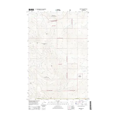
2014 Map of Murr Peak
USGS Topo · Published 2014About this map
Kootenai National Forest and Lolo National Forest converge across this high-elevation corner of Northwest Montana, defined by the administrative boundary of Flathead Co. The landscape is a complex of significant peaks, notably Murr Peak, Bold Peak, and Tepee Mtn, which anchor the surrounding drainage basins. High-country landmarks such as Castle Rock and Pinehill overlook a network of seasonal and perennial waters, including the N Fork Murr Cr and Briggs Cr. The map captures the specialized geography of the northern Rockies just after the turn of the century, where the absence of developed settlements emphasizes the role of the Forest Service in managing these watersheds. Deep drainages like Mandy Gulch and the winding course of Redmond Cr illustrate the primary hydrological patterns through t25n r25w and t26n r25w.
Find a feature on this map
18 named features on this map. Tap any name to fly to it.
Don’t see what you’re looking for? This feature index may not catch every label — zoom into the map to look around manually.
Map Details
Editions of this 2014 Murr Peak Map
This is the sole edition of this map. No revisions or reprints were ever made.
Other maps of this area

1956 · Wallace
USGS Topo · 1:250,000

1957 · Kalispell
USGS Topo · 1:250,000

1960 · Kalispell
USGS Topo · 1:250,000

1960 · Wallace
USGS Topo · 1:250,000

1961 · Kalispell
USGS Topo · 1:250,000

1964 · Meadow Peak
USGS Topo · 1:24,000

1964 · Mill Pocket Creek
USGS Topo · 1:24,000

1964 · Hubbart Reservoir
USGS Topo · 1:24,000
1964 · Cook Mountain
USGS Topo · 1:24,000
1964 · Shroder Creek
USGS Topo · 1:24,000