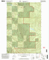
1999 Map of Murr Peak
USGS Topo · Published 2003About this map
The Flathead Indian Reservation meets the southern boundary of the Lolo National Forest in this late 20th-century survey of the high Montana divide. The landscape is defined by its significant drainage networks, including Briggs Creek and Tamarack Creek, which carve through the elevations near the border of Flathead Co Sanders Co. A small Gravel Pit near the Plains Ranger District provides a rare marker of industrial activity in a region otherwise dominated by peaks and forest management.
Find a feature on this map
21 named features on this map. Tap any name to fly to it.
Don’t see what you’re looking for? This feature index may not catch every label — zoom into the map to look around manually.
Map Details
Editions of this 1999 Murr Peak Map
This is the sole edition of this map. No revisions or reprints were ever made.
Other maps of this area

1956 · Wallace
USGS Topo · 1:250,000

1957 · Kalispell
USGS Topo · 1:250,000

1960 · Kalispell
USGS Topo · 1:250,000

1960 · Wallace
USGS Topo · 1:250,000

1961 · Kalispell
USGS Topo · 1:250,000

1964 · Meadow Peak
USGS Topo · 1:24,000

1964 · Mill Pocket Creek
USGS Topo · 1:24,000

1964 · Hubbart Reservoir
USGS Topo · 1:24,000
1964 · Cook Mountain
USGS Topo · 1:24,000
1964 · Shroder Creek
USGS Topo · 1:24,000