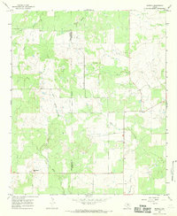
1966 Map of Murray
USGS Topo · Published 1969About this map
Oil Field activity and ranching terrain dominate the border between Throckmorton and Young counties in this mid-1960s study. The settlement of Murray serves as the primary local hub, positioned near the convergence of several drainages that define the topography. The landscape is carved by the North Fork Fish Creek and East Kings Creek, which flow through undulating hills marked by specific landmarks like Matthews Hill and the level expanse of Coffee Flat.
Find a feature on this map
13 named features on this map. Tap any name to fly to it.
Don’t see what you’re looking for? This feature index may not catch every label — zoom into the map to look around manually.
Map Details
Editions of this 1966 Murray Map
2 editions found
Other maps of this area

1890 · Breckenridge
USGS Topo · 1:125,000

1892 · Albany
USGS Topo · 1:125,000

1893 · Albany
USGS Topo · 1:125,000

1954 · Abilene
USGS Topo · 1:250,000

1954 · Wichita Falls
USGS Topo · 1:250,000

1958 · Wichita Falls
USGS Topo · 1:250,000

1958 · Abilene
USGS Topo · 1:250,000

1965 · Lusk
USGS Topo · 1:24,000

1965 · Throckmorton NE
USGS Topo · 1:24,000
1966 · Woodson
USGS Topo · 1:24,000