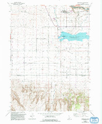
1965 Map of Murtaugh
USGS Topo · Published 1992About this map
Murtaugh sits at the northern edge of this landscape, where the agricultural plains meet the dramatic canyon of the Snake River. This 1965 survey (updated through 1992) captures a complex water management system vital to the Magic Valley, featuring the Twin Falls Canal, the Milner Ditch, and Murtaugh Lake. The topography shifts from the level irrigation fields surrounding the High School to the prominent rise of Hansen Butte and the deep drainage of Dry Creek.
Find a feature on this map
26 named features on this map. Tap any name to fly to it.
Don’t see what you’re looking for? This feature index may not catch every label — zoom into the map to look around manually.
Map Details
Editions of this 1965 Murtaugh Map
2 editions found
Other maps of this area

1955 · Twin Falls
USGS Topo · 1:250,000

1958 · Twin Falls
USGS Topo · 1:250,000

1964 · Kimberly
USGS Topo · 1:24,000

1964 · Eden
USGS Topo · 1:24,000

1964 · Milner
USGS Topo · 1:24,000

1965 · Rams Horn Ridge
USGS Topo · 1:24,000

1965 · Milner Butte
USGS Topo · 1:24,000

1965 · Stricker Butte
USGS Topo · 1:24,000

1965 · Grand View Peak
USGS Topo · 1:24,000

1965 · Murtaugh
USGS Topo · 1:24,000