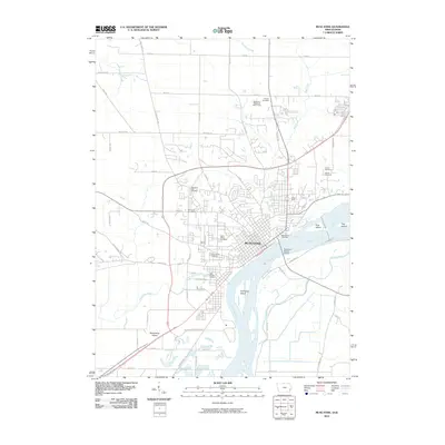
2010 Map of Muscatine
USGS Topo · Published 2010About this map
Muscatine serves as the focal point of this 2010 survey, showcasing the city's complex relationship with the winding Mississippi River. The urban footprint is defined by its industrial and civic infrastructure, including the Muscatine Post Office and the riverfront Mark Twain Overlook. Large-scale geographic features like Muscatine Island to the south and the smaller Hog Island to the east illustrate the shifting nature of the river's path, while the Norman F Beckey Bridge provides the primary link between the Iowa and Illinois shores. For genealogists, the map is particularly detailed, locating numerous burial grounds such as Greenwood Cemetery, Saint Marys Cemetery, and Friends Cemetery. The layout of the city and its surrounding drainage systems, including Mad Creek and Muscatine Slough, highlights how the local topography has been adapted for both municipal growth and recreation at the Muscatine Municipal Golf Course.
Find a feature on this map
62 named features on this map. Tap any name to fly to it.
Don’t see what you’re looking for? This feature index may not catch every label — zoom into the map to look around manually.
Map Details
Editions of this 2010 Muscatine Map
This is the sole edition of this map. No revisions or reprints were ever made.
Other maps of this area

1890 · Durant
USGS Topo · 1:62,500

1891 · Wilton Junction
USGS Topo · 1:62,500

1894 · Durant
USGS Topo · 1:62,500

1901 · Rock Island
USGS Topo · 1:125,000

1901 · Stanwood
USGS Topo · 1:125,000

1910 · Rock Island
USGS Topo · 1:125,000

1916 · Edgington
USGS Topo · 1:62,500

1938 · Edgington
USGS Topo · 1:62,500

1948 · Muscatine
USGS Topo · 1:62,500

1953 · Wilton Junction
USGS Topo · 1:24,000