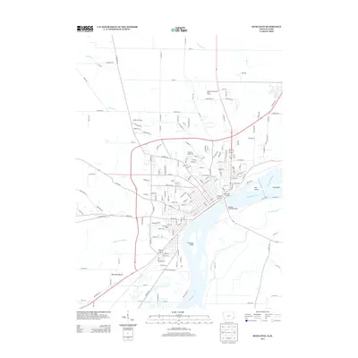
2013 Map of Muscatine
USGS Topo · Published 2013About this map
The Mississippi River dominates this landscape, defining the eastern border of Iowa and shaping the complex network of waterways south of the city center. This early 21st-century view reveals the industrial and recreational layout of Muscatine, where the Norman F Beckey Bridge provides a critical connection across the river. To the south, Muscatine Slough and Muscatine Island illustrate the alluvial nature of the terrain, while landmarks like the Mark Twain Overlook highlight the town's literary and riverboat heritage. Further inland, the map details the expansion of residential and recreational spaces, including the Muscatine Municipal Golf Course and athletic grounds like Heinz Field and Tom Bruner Field. The presence of Jewish Cemetery Rd in the northeast quadrant offers a specific point of interest for genealogists tracing local family histories.
Find a feature on this map
158 named features on this map. Tap any name to fly to it.
Don’t see what you’re looking for? This feature index may not catch every label — zoom into the map to look around manually.
Map Details
Editions of this 2013 Muscatine Map
This is the sole edition of this map. No revisions or reprints were ever made.
Other maps of this area

1890 · Durant
USGS Topo · 1:62,500

1891 · Wilton Junction
USGS Topo · 1:62,500

1894 · Durant
USGS Topo · 1:62,500

1901 · Rock Island
USGS Topo · 1:125,000

1901 · Stanwood
USGS Topo · 1:125,000

1910 · Rock Island
USGS Topo · 1:125,000

1916 · Edgington
USGS Topo · 1:62,500

1938 · Edgington
USGS Topo · 1:62,500

1948 · Muscatine
USGS Topo · 1:62,500

1953 · Wilton Junction
USGS Topo · 1:24,000