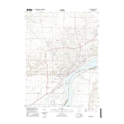
2015 Map of Muscatine
USGS Topo · Published 2015About this map
Muscatine sits prominently along the great western bend of the Mississippi River, where the Iowa shoreline meets the Illinois border. This landscape is defined by the river’s complex hydraulics, featuring massive navigational reaches like Pool 16 and numerous fluvial landforms including Hog Island, Towhead Island, and the expansive Muscatine Island. The city's infrastructure is anchored by the Norman F Beckey Bridge, which connects the two states, while the Soo Line railroad maintains the historical transportation corridor through the valley.
Find a feature on this map
164 named features on this map. Tap any name to fly to it.
Don’t see what you’re looking for? This feature index may not catch every label — zoom into the map to look around manually.
Map Details
Editions of this 2015 Muscatine Map
This is the sole edition of this map. No revisions or reprints were ever made.
Other maps of this area

1890 · Durant
USGS Topo · 1:62,500

1891 · Wilton Junction
USGS Topo · 1:62,500

1894 · Durant
USGS Topo · 1:62,500

1901 · Rock Island
USGS Topo · 1:125,000

1901 · Stanwood
USGS Topo · 1:125,000

1910 · Rock Island
USGS Topo · 1:125,000

1916 · Edgington
USGS Topo · 1:62,500

1938 · Edgington
USGS Topo · 1:62,500

1948 · Muscatine
USGS Topo · 1:62,500

1953 · Wilton Junction
USGS Topo · 1:24,000