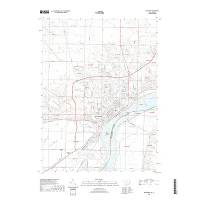
2018 Map of Muscatine
USGS Topo · Published 2018About this map
Muscatine is defined by its position on the western bank of the Mississippi River, where the landscape transitions from riverine lowlands to upland ridges. The city's northern reaches are marked by elevated terrain such as Sunflower Ridge, Prairie Rose Ridge, and Cattail Ridge, while the southern area is dominated by the broad expanse of Muscatine Island. Numerous historic burial grounds are scattered throughout the quadrangle, including the large Greenwood Cem and Memorial Park Cem, as well as the Jewish Cem and Gilbert Cem to the east. Transportation and commerce across the river are facilitated by the Norman F Beckey Bridge, connecting Iowa to Illinois across a complex network of waterways including the Wyoming Slough and Muscatine Slough. Small tributaries like Chicken Cr, Mosquito Cr, and Mad Cr drain the northern hills into the main river channel.
Find a feature on this map
89 named features on this map. Tap any name to fly to it.
Don’t see what you’re looking for? This feature index may not catch every label — zoom into the map to look around manually.
Map Details
Editions of this 2018 Muscatine Map
This is the sole edition of this map. No revisions or reprints were ever made.
Other maps of this area

1890 · Durant
USGS Topo · 1:62,500

1891 · Wilton Junction
USGS Topo · 1:62,500

1894 · Durant
USGS Topo · 1:62,500

1901 · Rock Island
USGS Topo · 1:125,000

1901 · Stanwood
USGS Topo · 1:125,000

1910 · Rock Island
USGS Topo · 1:125,000

1916 · Edgington
USGS Topo · 1:62,500

1938 · Edgington
USGS Topo · 1:62,500

1948 · Muscatine
USGS Topo · 1:62,500

1953 · Wilton Junction
USGS Topo · 1:24,000