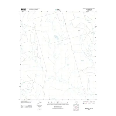
2012 Map of Mushaway Peak
USGS Topo · Published 2012About this map
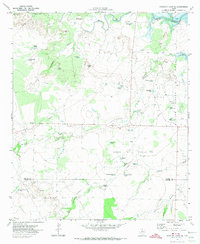
Mushaway Peak rises above the expansive ranchlands of Borden County, serving as a primary landmark in this west Texas landscape. The drainage patterns of Hullem Cr, Grape Cr, and Little Grape Cr define the territory, eventually feeding toward the Colorado River in the south. This 2012 survey illustrates a landscape dominated by livestock and water management, evidenced by the high density of named water tanks that support the local cattle industry. Many of these reservoirs, such as Bombsight Tank, Sourdough Tank, and Smoot Tank, carry names likely rooted in the specific local history and colloquialisms of the ranchers who worked this land. Access to these remote reaches is maintained by a network of rural roads, including FM-669 and Willow Valley Rd, which navigate the space between landmarks like Edwards Lake and the Prairie Hill Tank.
Find a feature on this map
28 named features on this map. Tap any name to fly to it.
Don’t see what you’re looking for? This feature index may not catch every label — zoom into the map to look around manually.
Map Details
Editions of this 2012 Mushaway Peak Map
This is the sole edition of this map. No revisions or reprints were ever made.
Other maps of this area

1954 · Big Spring
USGS Topo · 1:250,000

1958 · Big Spring
USGS Topo · 1:250,000

1969 · Gail
USGS Topo · 1:24,000

1969 · Holloway Canyon
USGS Topo · 1:24,000
1969 · Fivemile Creek
USGS Topo · 1:24,000

1970 · Vealmoor
USGS Topo · 1:24,000

1970 · Mushaway Peak
USGS Topo · 1:24,000
1970 · Gunsight Draw
USGS Topo · 1:24,000
1970 · Gunsight Draw NE
USGS Topo · 1:24,000
1970 · Gunsight Draw SE
USGS Topo · 1:24,000