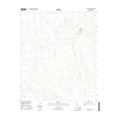
2016 Map of Mushaway Peak
USGS Topo · Published 2016About this map
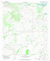
Mushaway Peak rises as a prominent landmark in this Borden County landscape, overseeing a complex network of ephemeral drainage and ranching infrastructure. The terrain is defined by its water management, evidenced by the numerous tanks such as Sourdough Tank, Bombsight Tank, and Behind Horse Pasture Tank that dot the arid environment. These features, along with names like Shipping Trap Tanks, reveal a landscape shaped by livestock ranching and the necessity of water storage in West Texas. The southern edge of the area is bounded by the Colorado River, which receives runoff from the northern draws of Little Grape Cr and Grape Cr. Transport through this cattle country is facilitated by FM 669 and Willow Valley Rd, connecting remote pastures to larger regional hubs. Notable landmarks including Edwards Lake and River Hill Tank provide specific points of reference for local historians tracing land use and property boundaries in this part of the state.
Find a feature on this map
27 named features on this map. Tap any name to fly to it.
Don’t see what you’re looking for? This feature index may not catch every label — zoom into the map to look around manually.
Map Details
Editions of this 2016 Mushaway Peak Map
This is the sole edition of this map. No revisions or reprints were ever made.
Other maps of this area

1954 · Big Spring
USGS Topo · 1:250,000

1958 · Big Spring
USGS Topo · 1:250,000

1969 · Gail
USGS Topo · 1:24,000

1969 · Holloway Canyon
USGS Topo · 1:24,000
1969 · Fivemile Creek
USGS Topo · 1:24,000

1970 · Vealmoor
USGS Topo · 1:24,000

1970 · Mushaway Peak
USGS Topo · 1:24,000
1970 · Gunsight Draw
USGS Topo · 1:24,000
1970 · Gunsight Draw NE
USGS Topo · 1:24,000
1970 · Gunsight Draw SE
USGS Topo · 1:24,000