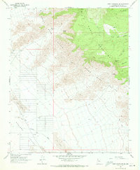
1968 Map of Music Mountains SE
USGS Topo · Published 1971About this map
The Grand Wash Cliffs dominate this 1960s desert landscape, marking a sharp geological transition between the high plateaus and the lower basin. To the east, the Music Mountains and Black Mesa overlook the Hualapai Indian Reservation, while the western portion of the sheet opens into the wide Hualapai Valley. This era of the survey reveals a cattle-ranching landscape defined by remote outposts and vital water sources, including the Henifin Ranch and a series of scattered springs such as Kohinoor Spring, Coyote Spring, and Cedar Spring. The presence of several corrals, a Dry Well, and a Water Tank underscore the challenges of maintaining livestock in this arid environment. Significant Sand Dunes shift across the valley floor, crossed only by occasional Jeep Trails, illustrating the isolation of this corner of Mohave County during the late 1960s.
Find a feature on this map
17 named features on this map. Tap any name to fly to it.
Don’t see what you’re looking for? This feature index may not catch every label — zoom into the map to look around manually.
Map Details
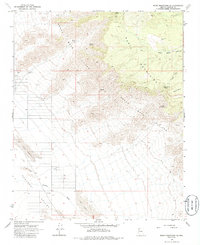
Editions of this 1968 Music Mountains SE Map
2 editions found
Other maps of this area

1886 · Diamond Creek
USGS Topo · 1:250,000

1892 · Diamond Creek
USGS Topo · 1:250,000

1948 · Williams
USGS Topo · 1:250,000

1954 · Williams
USGS Topo · 1:250,000

1956 · Williams
USGS Topo · 1:250,000

1960 · Williams
USGS Topo · 1:250,000

1961 · Williams
USGS Topo · 1:250,000

1967 · Milkweed Canyon SW
USGS Topo · 1:24,000
1967 · Milkweed Canyon NW
USGS Topo · 1:24,000
1968 · Long Mountain
USGS Topo · 1:24,000