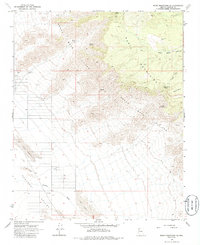
1968 Map of Music Mountains SE
USGS Topo · Published 1986About this map
Grand Wash Cliffs dominate the landscape of this Mohave County quadrangle, marking a dramatic geological transition where the high plateau meets the Hualapai Valley. At the edge of these escarpments, the Music Mountains rise sharply, their slopes dotted with critical water sources such as Coyote Spring, Kohinoor Spring, and Pole Corral Spring. These isolated springs and wells were the lifeblood for early ranching efforts in this arid territory, supporting outposts like Henifin Ranch and aiding travelers navigating the primitive network of canyon roads.
Find a feature on this map
18 named features on this map. Tap any name to fly to it.
Don’t see what you’re looking for? This feature index may not catch every label — zoom into the map to look around manually.
Map Details
Editions of this 1968 Music Mountains SE Map
2 editions found
Other maps of this area

1886 · Diamond Creek
USGS Topo · 1:250,000

1892 · Diamond Creek
USGS Topo · 1:250,000

1948 · Williams
USGS Topo · 1:250,000

1954 · Williams
USGS Topo · 1:250,000

1956 · Williams
USGS Topo · 1:250,000

1960 · Williams
USGS Topo · 1:250,000

1961 · Williams
USGS Topo · 1:250,000

1967 · Milkweed Canyon SW
USGS Topo · 1:24,000
1967 · Milkweed Canyon NW
USGS Topo · 1:24,000
1968 · Long Mountain
USGS Topo · 1:24,000