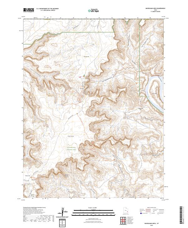
2023 Map of Musselman Arch
USGS Topo · Published 2023About this map
Canyonlands National Park defines this corner of San Juan County, where the high mesa of Island in the Sky drops away into a complex network of sheer-walled drainages. The geography is centered on The Neck, a narrow land bridge that provides the only terrestrial access to the southern plateau. Below these heights, the Colorado River carves a deep path through the eastern portion of the quadrangle, creating the dramatic sharp bend at Goose Neck and passing near the hidden stone span of Musselman Arch.
Find a feature on this map
30 named features on this map. Tap any name to fly to it.
Don’t see what you’re looking for? This feature index may not catch every label — zoom into the map to look around manually.
Map Details
Editions of this 2023 Musselman Arch Map
This is the sole edition of this map. No revisions or reprints were ever made.
Other maps of this area

1885 · La Sal
USGS Topo · 1:250,000

1951 · The Knoll
USGS Topo · 1:62,500

1951 · Upheaval Dome
USGS Topo · 1:62,500

1952 · Carlisle 2 SE
USGS Topo · 1:24,000

1952 · Carlisle 2 NW
USGS Topo · 1:24,000

1952 · Moab 3 SE
USGS Topo · 1:24,000

1952 · Carlisle 2 NE
USGS Topo · 1:24,000

1952 · Carlisle 2 SW
USGS Topo · 1:24,000

1952 · Moab 3 SW
USGS Topo · 1:24,000

1952 · Moab 4 SW
USGS Topo · 1:24,000