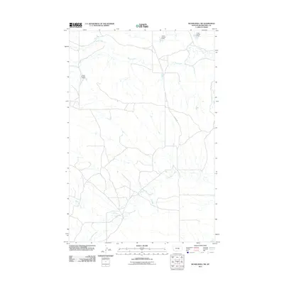
2011 Map of Musselshell NW
USGS Topo · Published 2011About this map
Howard Creek and its seasonal tributaries define the landscape of this Musselshell County region during the early twenty-first century. The map provides a detailed view of local water management infrastructure, specifically a series of reservoirs including Gofara Number 6 Dam, Gofara Number 7 Dam, and Gofara Number 8 Dam. These features illustrate the vital role of water storage in this part of Montana, where the terrain is drained by systems like North Willow Creek and Little Wall Creek. Human presence is marked by a sparse network of section lines and local transit routes such as Fourmile Rd, reflecting the open, pastoral character of the area northwest of Musselshell.
Find a feature on this map
7 named features on this map. Tap any name to fly to it.
Don’t see what you’re looking for? This feature index may not catch every label — zoom into the map to look around manually.
Map Details
Editions of this 2011 Musselshell NW Map
This is the sole edition of this map. No revisions or reprints were ever made.
Other maps of this area

1954 · Roundup
USGS Topo · 1:250,000

1958 · Roundup
USGS Topo · 1:250,000

1963 · Kelley
USGS Topo · 1:24,000

1963 · Musselshell
USGS Topo · 1:24,000
1963 · Akers Ranch
USGS Topo · 1:24,000

1963 · Musselshell NW
USGS Topo · 1:24,000
1963 · Mud Spring
USGS Topo · 1:24,000

1963 · Delphia
USGS Topo · 1:24,000

1986 · Crowley Dam
USGS Topo · 1:24,000
1986 · Big Wall East
USGS Topo · 1:24,000