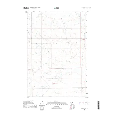
2020 Map of Musselshell NW
USGS Topo · Published 2020About this map
Haraldson Spring sits within a landscape defined by high plains and drainage coulees in Musselshell County, reflecting the sparse water resources critical to central Montana ranching operations. The terrain is structured by the seasonal flows of Howard Cr in the north and the headwaters of N Willow Cr and Little Wall Cr to the south. This 2020 survey illustrates the remote grid of township and range lines, where Fourmile Rd serves as a primary artery through the open range. The map reveals the intricate contouring of the region's breaks and draws, detailing a geography where named water sources like Haraldson Spring often determined the location of early homesteads and grazing boundaries.
Find a feature on this map
9 named features on this map. Tap any name to fly to it.
Don’t see what you’re looking for? This feature index may not catch every label — zoom into the map to look around manually.
Map Details
Editions of this 2020 Musselshell NW Map
This is the sole edition of this map. No revisions or reprints were ever made.
Other maps of this area

1954 · Roundup
USGS Topo · 1:250,000

1958 · Roundup
USGS Topo · 1:250,000

1963 · Kelley
USGS Topo · 1:24,000

1963 · Musselshell
USGS Topo · 1:24,000
1963 · Akers Ranch
USGS Topo · 1:24,000

1963 · Musselshell NW
USGS Topo · 1:24,000
1963 · Mud Spring
USGS Topo · 1:24,000

1963 · Delphia
USGS Topo · 1:24,000

1986 · Crowley Dam
USGS Topo · 1:24,000
1986 · Big Wall East
USGS Topo · 1:24,000