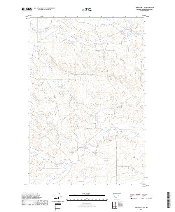
2024 Map of Musselshell NW
USGS Topo · Published 2024About this map
North Willow Creek and Little Wall Creek wind through this high prairie landscape of Musselshell County, defining the drainage patterns of the central Montana rangeland. The terrain is characterized by complex contouring and intermittent watercourses typical of the region, where the primary infrastructure consists of solitary routes like Fourmile Rd. This recent topographical survey highlights the enduring rural layout of the Public Land Survey System, specifically within Townships 10 and 11 North. The presence of Howard Creek in the northern reaches of the quadrangle further illustrates the sparse but critical water network that has historically supported ranching and land use in this part of the state.
Find a feature on this map
8 named features on this map. Tap any name to fly to it.
Don’t see what you’re looking for? This feature index may not catch every label — zoom into the map to look around manually.
Map Details
Editions of this 2024 Musselshell NW Map
This is the sole edition of this map. No revisions or reprints were ever made.
Other maps of this area

1954 · Roundup
USGS Topo · 1:250,000

1958 · Roundup
USGS Topo · 1:250,000

1963 · Kelley
USGS Topo · 1:24,000

1963 · Musselshell
USGS Topo · 1:24,000
1963 · Akers Ranch
USGS Topo · 1:24,000

1963 · Musselshell NW
USGS Topo · 1:24,000
1963 · Mud Spring
USGS Topo · 1:24,000

1963 · Delphia
USGS Topo · 1:24,000

1986 · Crowley Dam
USGS Topo · 1:24,000
1986 · Big Wall East
USGS Topo · 1:24,000